Data Collection Operations
Explore the technical architecture and modular mission profiles that power our autonomous data ecosystem.
Mission Templates

Point of Interest
Orbital flight around a ground-based asset with the sensor gimbal locked to the center.

Area Scanning
Autonomous lawnmower pattern flight following a high-precision grid for mapping.

360 Waypoint
Stationary 360° panoramic capture at every defined waypoint for full-view documentation.

Linear
Continuous straight-line data collection between waypoints, optimized for corridors.

Patrol Route
Grid pattern with automatic manual takeover once detection thresholds are triggered.
Sensor Control
Switch between high-resolution RGB visible data or Thermal IR. Dual-sensor fusion allows for overlaying heat maps on architectural visuals in real-time.
Optical Zoom
Leverage up to x56 hybrid zoom. For Point of Interest and 360 Waypoint missions, users can select multiple zoom levels to be captured sequentially at every waypoint.
- Standard Missions Linear / Area Slider
- Multi-Step Missions POI / 360 Multi-Select
Gimbal Orientation
The gimbal pitch automatically adapts to the selected mission template to ensure the sensor stays perpendicular to the target.
- Point of Interest Locked to Target
- Linear -90° to 25°
- 360 Waypoint -90° to 35°
- Area / Patrol -90° to -30°
Flight Velocity
Select optimal flight speed between 1 m/s for high-detail imagery and 15 m/s for rapid area coverage. The system automatically adjusts for wind resistance to maintain constant ground speed.
Course Orientation
For Area Scanning and Patrol missions, the course angle can be adjusted to align with site boundaries or wind directions, optimizing flight efficiency and overlap precision.
Data Logging
Choose your capture format. Continuous 4K raw video for motion analysis or discrete high-res images taken at specific distance intervals (meters) or time intervals (seconds).
Operational Context
Where these technical capabilities create value.
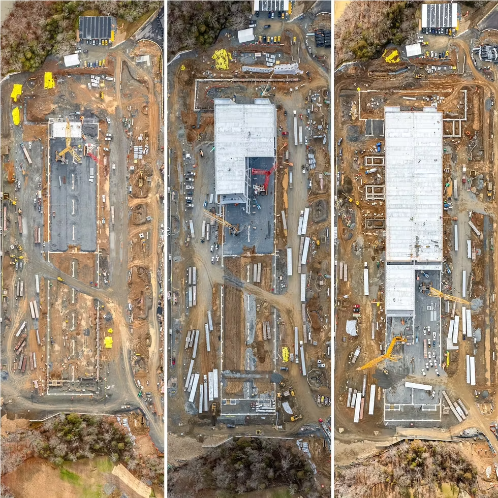
Progress Tracking
Automated daily site documentation for construction timeline verification.
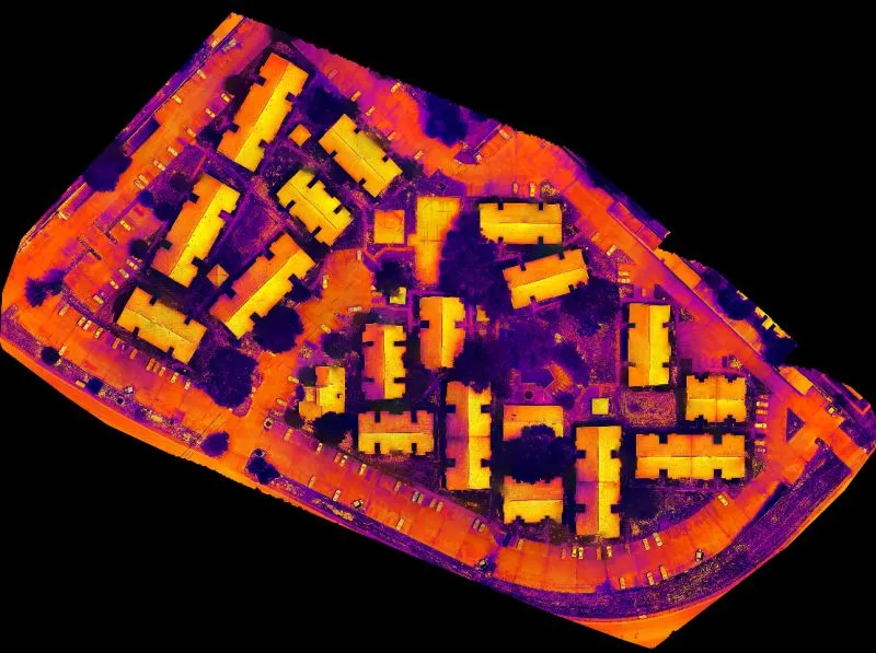
Urban Planning
High-res 3D modeling for infrastructure development and smart city zoning.
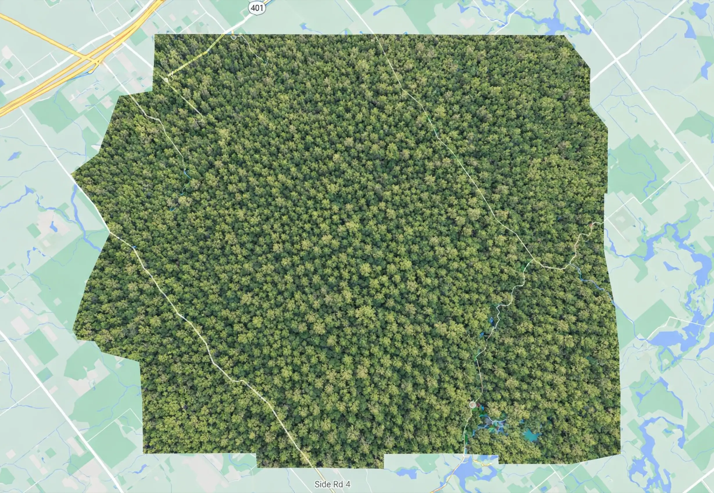
Environmental Monitoring
Canopy density and forest health analysis using multi-spectral IR data.
Configure Your Mission
Contact us to integrate SAI-HUB into your operational workflow.
Contact Sales