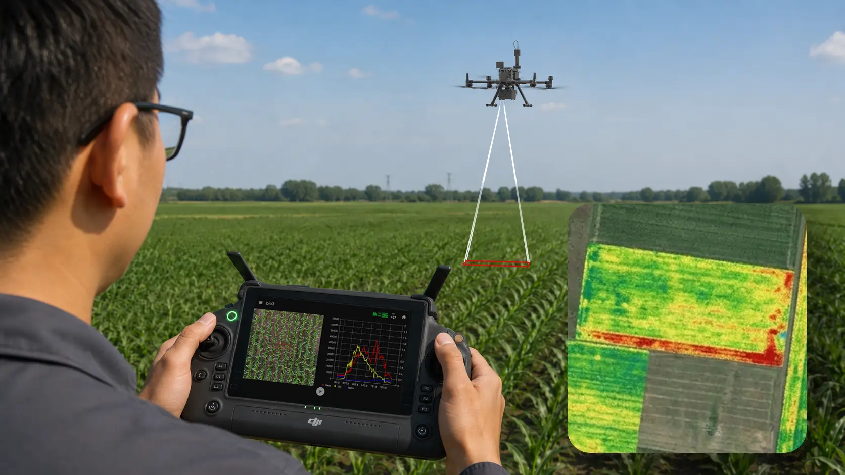
Drone-Based Spectral Mapping
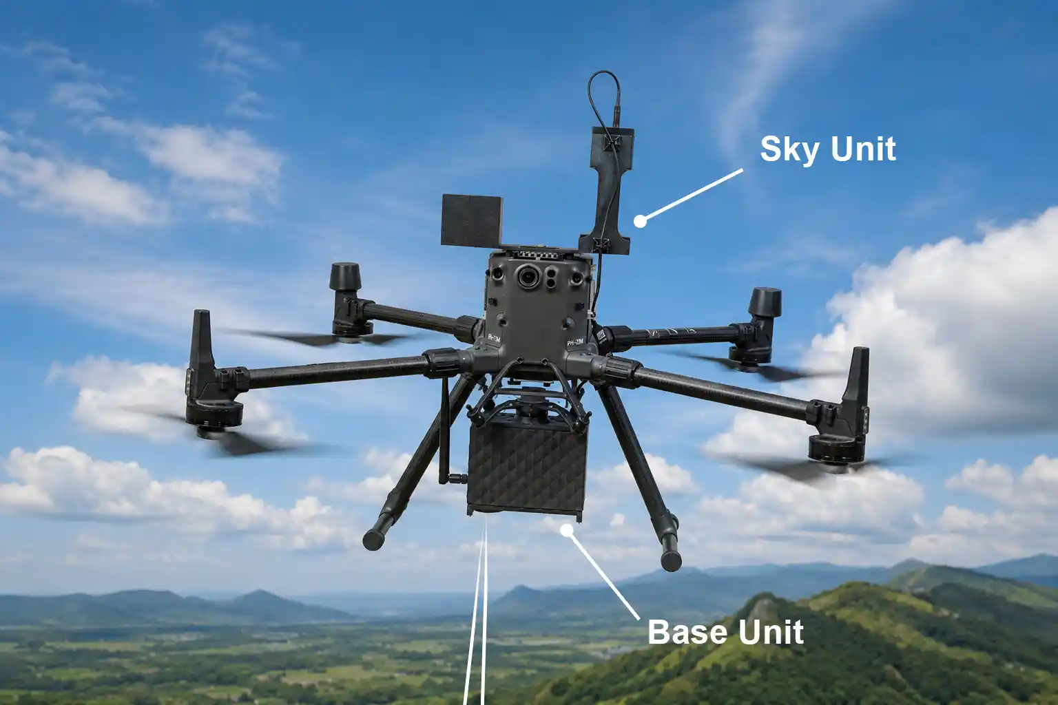
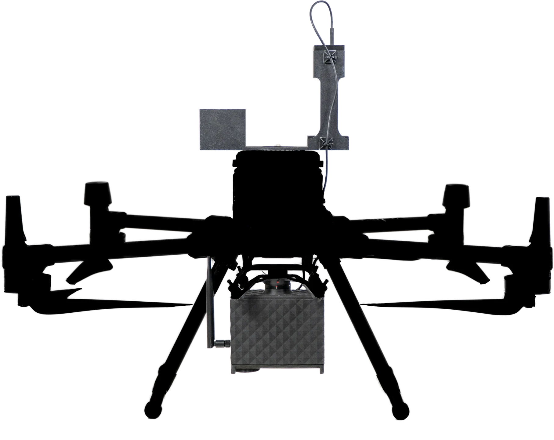
HyperSlit is built for the DJI Matrice 300 & 350 RTK.
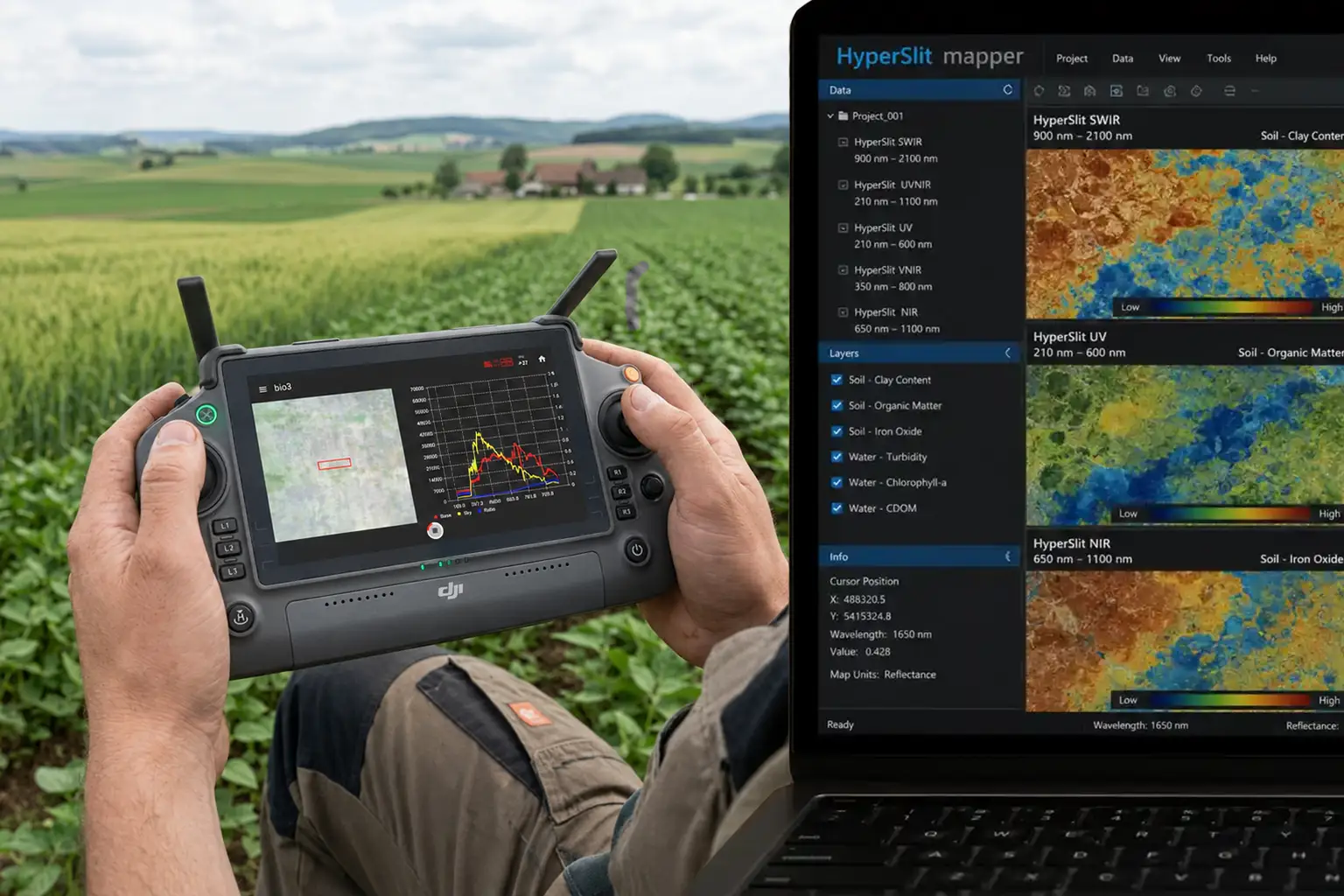
HyperSlit combines the spectral sensor, sky unit, live controller feedback, and desktop mapping software into one workflow for field measurement and spectral analysis.
One solution from flight planning to calibrated spectral maps.
HyperSlit combines airborne sensing, live viewing, atmospheric correction, and post-processing into one practical workflow.
HyperSlit spectral sensor
The airborne sensor records hyperspectral information at 0.5 nm spectral resolution, giving you detailed reflectance data for research, mapping, and surface comparison tasks.
Sky unit
The sky unit continuously captures white-reference measurements during flight, helping HyperSlit correct for atmospheric change, shifting sunlight, and cloud movement while the mission is running.
Field software
Plan area-scan missions, execute measurements on the controller, and watch the spectral signature change live as the drone moves over different surfaces and targets.
Desktop processing
Process captured data into spectral maps and export interpolated GeoTIFF outputs for further interpretation.

Capture, correct, and analyze with a clear mission sequence.
Move from route setup to calibrated output in three clear stages.
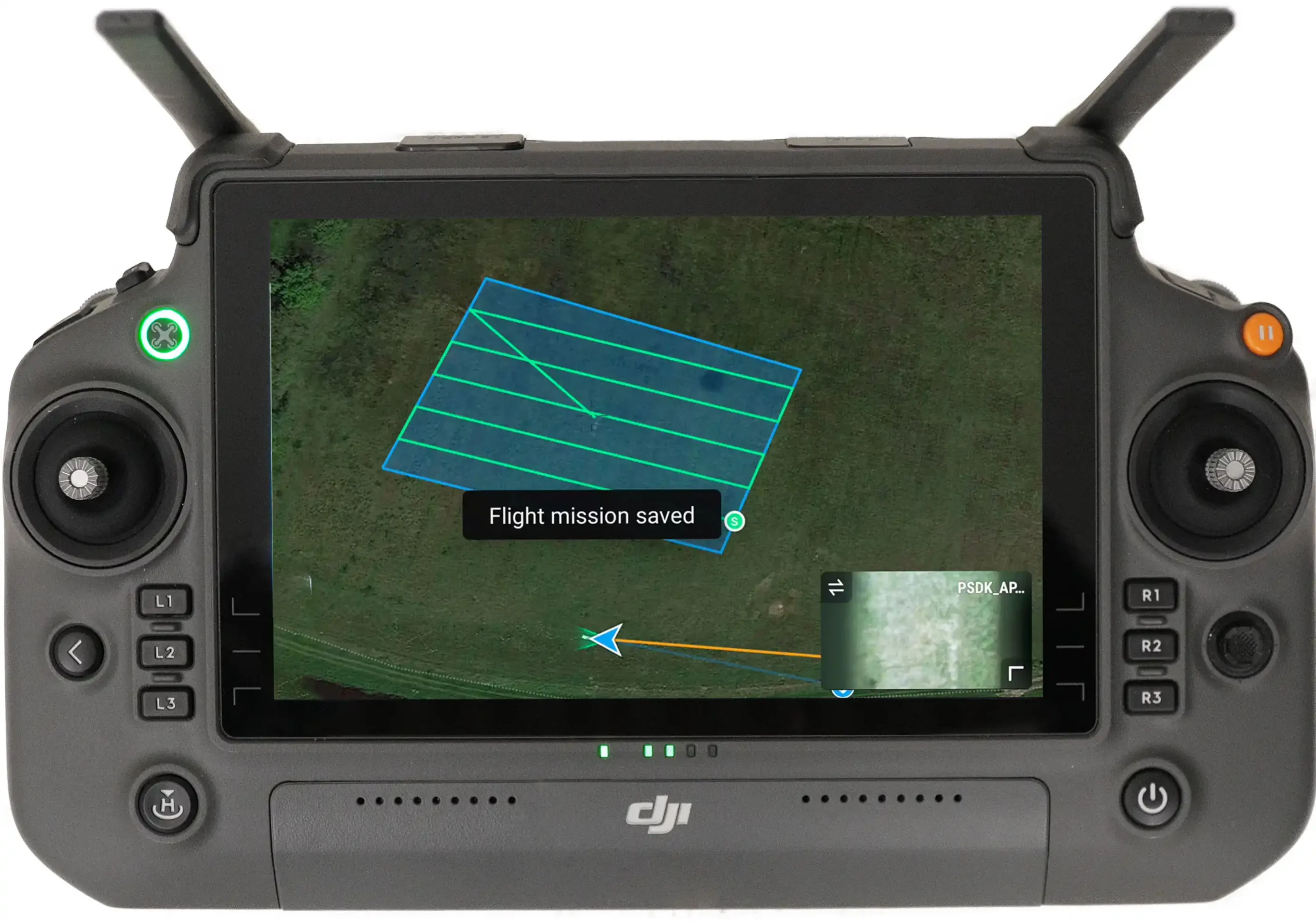
Flight planning
Create area-scan missions on the controller and prepare the capture route before takeoff. This makes repeatable field surveys easier and keeps coverage consistent across research plots or survey zones.
- Plan area measurements directly in the field
- Use a structured mission flow for repeat surveys
- Align coverage with the area you want to compare later
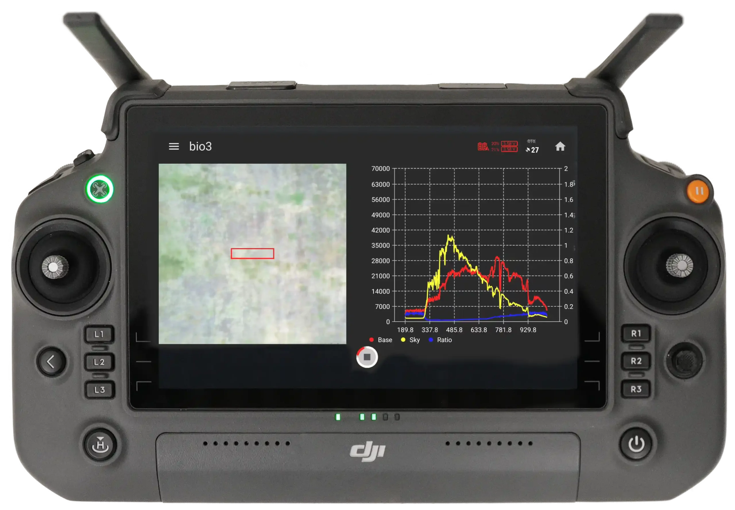
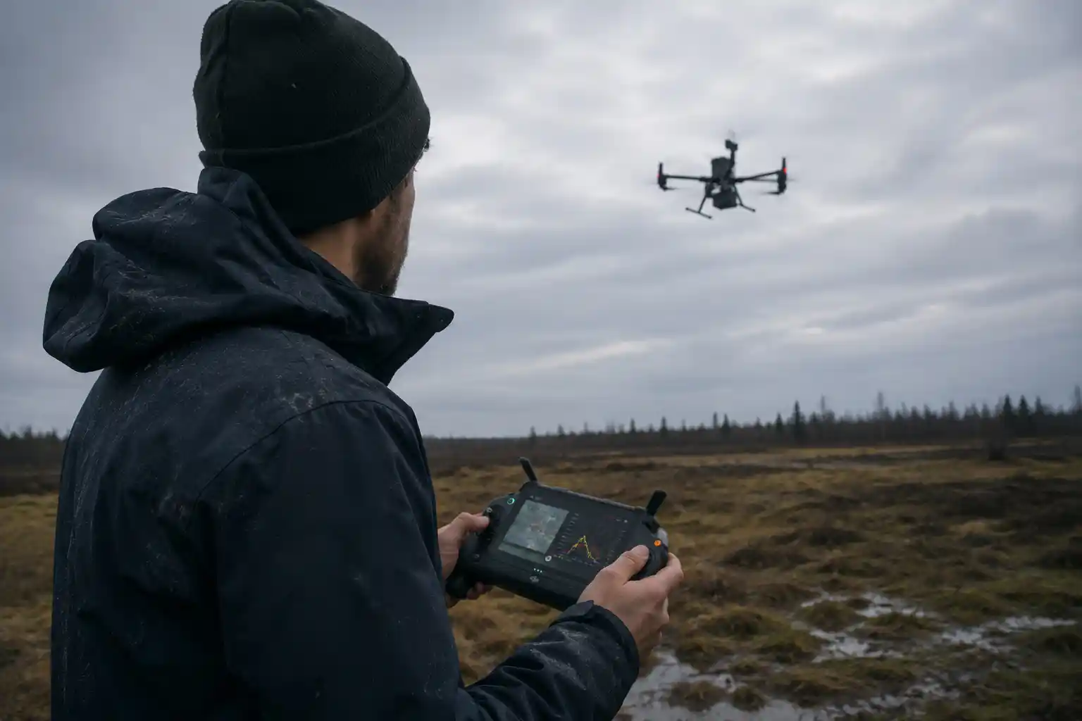
Real-time capture
During acquisition, the controller shows the live spectral signature so you can see how reflectance changes across water, soil, vegetation, and materials while the drone is in the air.
- View the spectral signature live on the controller
- Monitor sky ratio information while capturing
- Validate the measurement behavior before leaving the site
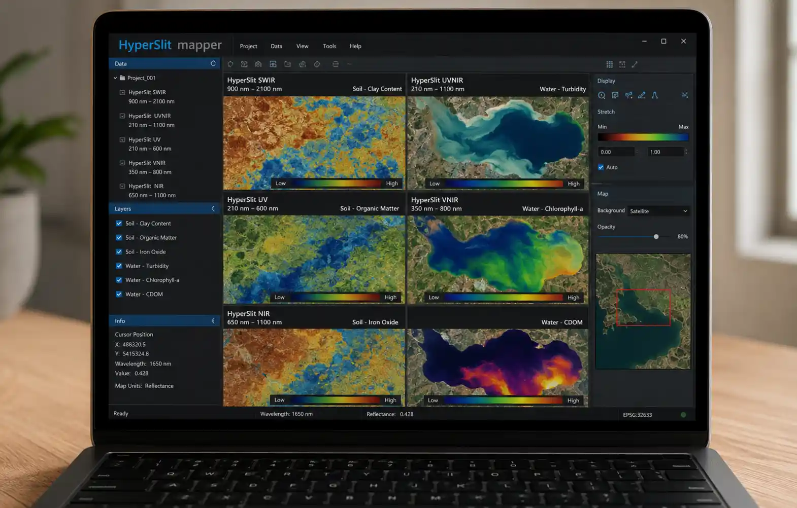
Process & analyze
After the flight, process the mission data on desktop software to create a clear spectral map. This is where the captured information becomes a visual layer you can interpret, compare, and export.
- Build map-based spectral outputs from the mission
- Review spatial patterns across the whole survey area
- Export interpolated GeoTIFF files for further analysis
Choose the HyperSlit range that matches your target surface.
Each model focuses on a different part of the spectrum, making it easier to match the sensor to the task.
Short-wave infrared reach
Useful when your workflow benefits from deeper material and moisture-sensitive spectral separation in the short-wave infrared range.
Broad UV to near-infrared coverage
A wide spectral option for teams that want one payload to cover a broad span of research use cases.
Ultraviolet-focused sensing
Built for workflows that prioritize ultraviolet and visible spectral behavior over longer wavelengths.
Visible to near-infrared balance
A practical range for many vegetation, surface condition, and general environmental sensing tasks.
Near-infrared specialization
Focused on the near-infrared zone for workflows where reflectance separation in that band is the main priority.
Two software environments, each with a clear role.
HyperSlit includes one app for field capture and one for desktop processing.
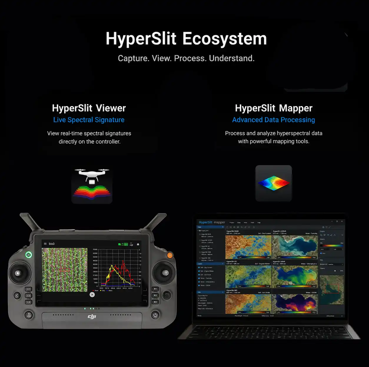
Controller App
HyperSlit Viewer
HyperSlit Viewer is used on the controller for mission planning, live spectral viewing, and field validation during capture.
- Plan area-scan missions in the field
- See the spectral signature update live on the controller
- Monitor sky ratio information during acquisition
Desktop Software
HyperSlit Mapper
HyperSlit Mapper processes the captured mission into map-based outputs for review, comparison, and export.
- Process missions into map-based spectral outputs
- Review patterns across the entire survey area
- Export interpolated GeoTIFF deliverables
The sky unit keeps measurements stable while conditions change.
The sky unit continuously tracks white-reference conditions so the system can correct for changing light during flight.
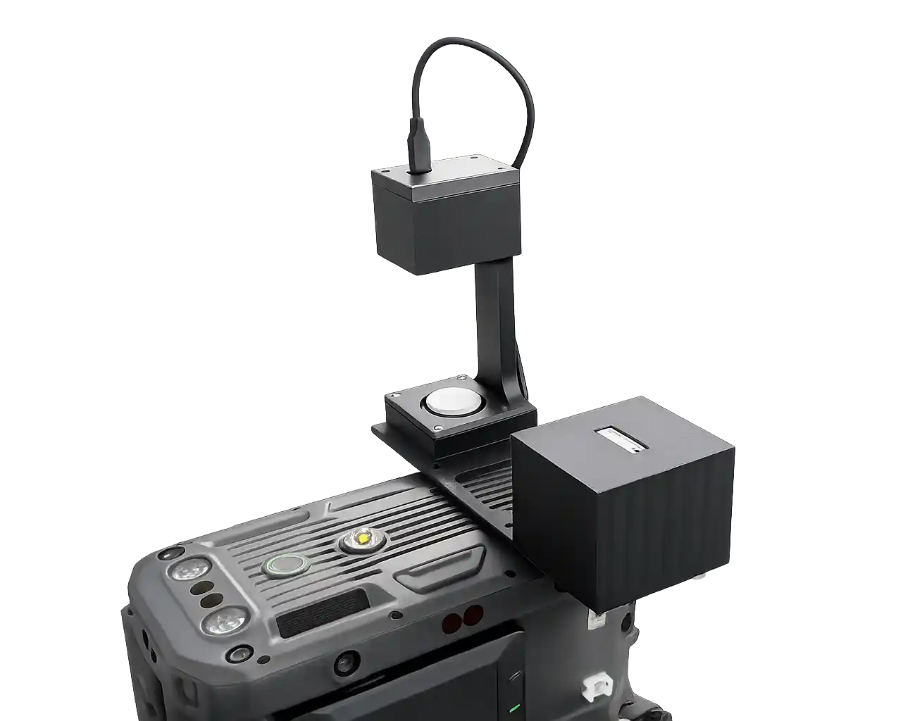
Designed as part of the full HyperSlit workflow
The sky unit is part of the measurement chain. Together with the sensor, controller interface, and desktop workflow it turns HyperSlit into a calibrated sensing pipeline rather than a standalone camera capture.
This is especially important for professional fieldwork where the same area may be compared across time, surfaces, or research campaigns.
Why the sky unit matters
The sky unit corrects for atmospheric changes in real time to protect data accuracy. That means your measurements stay more reliable even when sunlight shifts, thin clouds pass through, or field conditions change during a mission.
- Captures continuous white-reference measurements during flight
- Supports correction for changing light and atmospheric conditions
- Helps keep data comparable across the mission instead of only at takeoff
- Reduces the risk of inconsistent interpretation caused by environmental drift
Built for more than one type of spectral survey.
HyperSlit supports map-based spectral analysis across agriculture, water, soil, and broader environmental monitoring workflows.
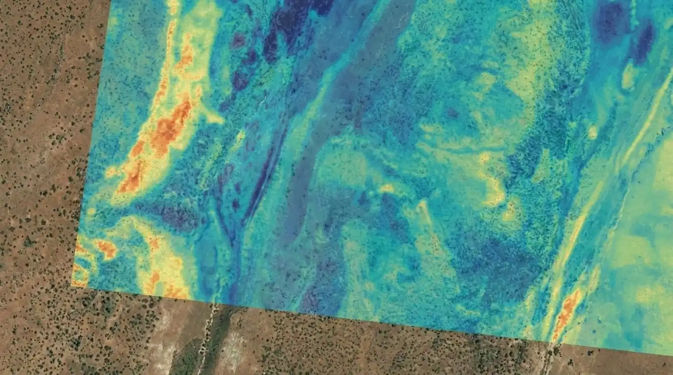
Map soil variability and surface composition.
Turn subtle reflectance differences into a spatial overview of changing soil conditions across the site.
- Assess iron and aluminum oxide related differences
- Compare moisture patterns and material variation
- Support zoning, sampling, and spectral library building
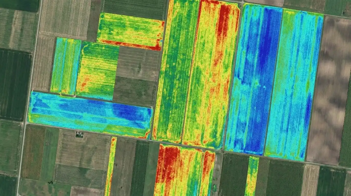
Compare crop response across the field.
Capture spectral variation in plant canopies to reveal crop response that standard RGB imagery can miss.
- Study vegetation health and plant stress behavior
- Compare plots, varieties, or treatment zones
- Support crop monitoring and repeat seasonal surveys
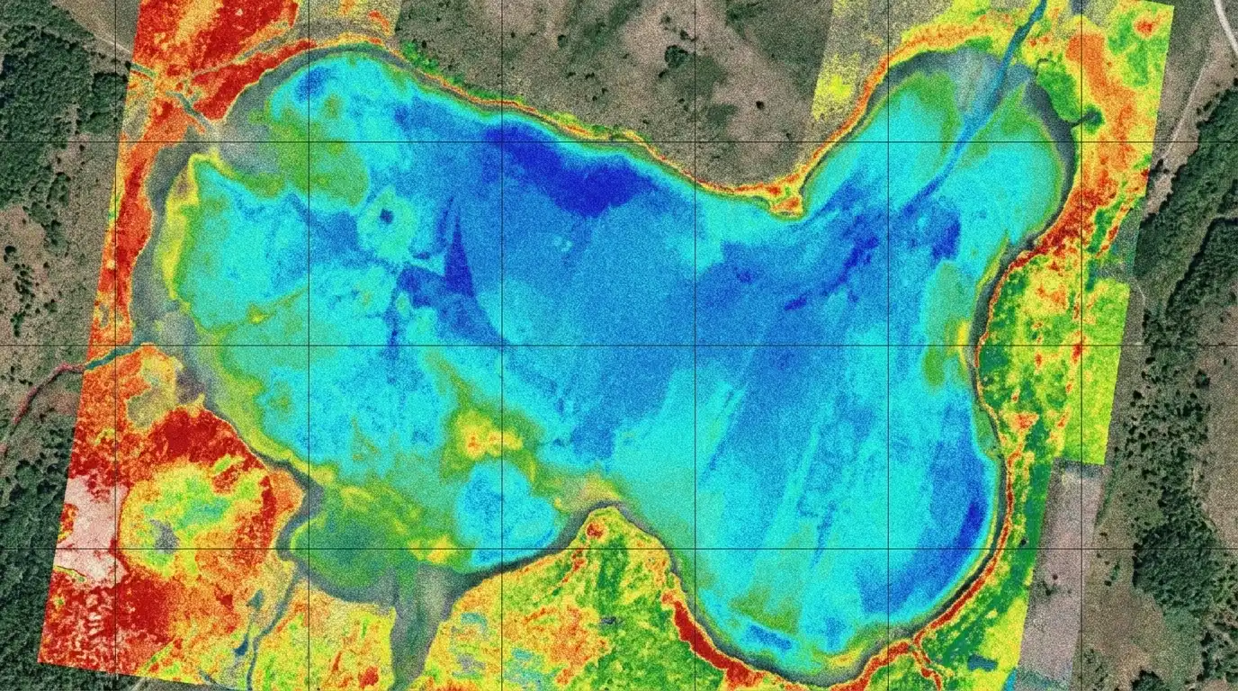
Survey water bodies with spatial spectral detail.
Map spectral differences across reservoirs, canals, shorelines, and changing aquatic conditions.
- Study chlorophyll-a related behavior and algae variation
- Track suspended matter and sediment movement
- Compare shoreline, inlet, outlet, and mixing zones

Support broader landscape and precision workflows.
Use spectral mapping for precision agriculture, environmental surveys, geoscience, and long-term monitoring campaigns.
- Support precision agriculture and field zoning
- Monitor changing land and surface conditions over time
- Build repeatable datasets for research campaigns
Core performance and platform details at a glance.
The HyperSlit system combines a compact airborne sensing package with field software and mapping output tools designed for professional drone operations.
Everything needed to operate HyperSlit as a complete sensing solution.
The package is built around the idea that hardware alone is not enough. HyperSlit includes the field components and software components required to go from mission planning to usable outputs.
Included hardware and field tools
- HyperSlit spectral sensor payload
- Sky unit for continuous white-reference capture
- Integrated RTK module
- Co-axial RGB camera
- 128 GB on-board memory
Included software and support
- HyperSlit Viewer for flight planning and area scans
- Live spectral signature and sky ratio view during capture
- HyperSlit Mapper for spectral map generation
- Interpolated GeoTIFF export
- Professional onboarding course and 2-year manufacturer warranty
HyperSlit gives your DJI Matrice platform a full spectral workflow.
From the first mission plan to the final mapped output, HyperSlit is built to help researchers and environmental professionals capture better spectral data, understand it faster, and turn it into a clearer basis for decisions in the field.